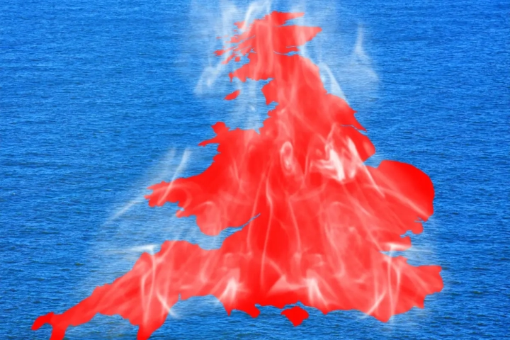
The Met Office has issued a Red Extreme Heat Warning for Wednesday and Thursday, with June’s all-time daily record temperature forecast to be broken.
The red warning joins the existing Amber Extreme Heat Warnings, which stretch from Monday through to the end of Thursday, covering much of southern and central England as well as much of Wales.
Temperatures will quickly rise on Monday and are forecast to reach 34°C in southern parts of England. However, this brings with it the chance of thundery showers for some.
The heat will build further into Tuesday, with highs of 37°C forecast for southern England and 35°C in southeast Wales. The peak of the heatwave is now forecast for Wednesday and Thursday, when temperatures are expected to climb to at least 39°C and there remains a chance of this being exceeded in places.
By Friday conditions will be less hot, with highs of 32°C forecast across eastern areas.
Overnight temperatures will also be very high, with widespread Tropical Nights, where the temperature does not drop below 20°C, across parts of England and Wales, especially in urban areas. Humidity is also a factor, making this heatwave even more impactful with heat stress a danger to all.
Dew points, which indicate how humid the air is, are forecast to reach around 22°C in places on Wednesday and Thursday. For comparison, during the record breaking July 2022 heatwave they were widely lower, highlighting how oppressive this heatwave will be.
It is now expected that the current UK highest temperature on record for June will very likely be broken, this being 35.6°C recorded in Southampton in June 1976 and Camden Square in June 1957. In addition, the Wales June temperature record of 33.7°C set in 2000 is also likely to be broken. The June record for Scotland stands at 32.2°C and for Northern Ireland it’s 30.8°C, and while these are less likely to be broken, even here we are expecting daytime temperatures in the high 20’s perhaps low 30’s °C.
Met Office Deputy Chief Forecaster Mark Sidaway, said: “Red warnings are reserved for the most severe events and we’re expecting severe and significant impacts from this heatwave, with health impacts likely for many, even beyond those who are normally more vulnerable to the heat. The last time the UK recorded temperatures this high was in July 2022, but on this occasion the heat is expected to be accompanied by high humidity.
“As well as very high daytime temperatures, there will be consecutive nights where temperatures do not drop below 20°C, which is called a Tropical Night. This will make it very hard for people to recover from the daytime heat, exacerbating the heat stress impacts.”
The forecast heatwave brings with it the likelihood of record-breaking June temperatures and very high humidity. The combination of heat and humidity will be oppressive and bring impacts across society from public health and infrastructure, to power and water supplies.
The warning also highlights the potential of heat-related issues for a range of sectors such as transport, energy and water supply.
An increase in potential water safety incidents is also noted, as more people are likely to visit coastal areas, lakes or rivers.
The UK Health Security Agency has also issued a series of Heat Health Alerts, which specifically highlight the potential health and social care impacts.
The exception for the hot conditions is further to the northwest, which is seeing more frequent cloud and rain on Monday with near-average temperatures. Cloud lingers for much of the week in the far northwest, with more persistent rain possible at times later in the week.
Staying safe in cold water
People heading to the coast should be mindful that sea-surface temperatures are not as high as they would be in mid-summer.
Samantha Hughes is the National Water Safety Partner at the RNLI. She said: “With warmer weather approaching, it’s important to remember that the water is still cold. Entering it unexpectedly can lead to cold water shock, causing a sudden increase in breathing and heart rate, which may trigger panic.
“If you find yourself struggling in the water, remember to Float to Live: tilt your head back so your ears are submerged, relax and control your breathing. You may need to gently use your hands to help you stay afloat, and it’s ok if your legs sink—everyone floats differently.
“Where possible, always choose a lifeguarded beach, and swim between the red and yellow flags. In a coastal emergency remember to call 999 for the coastguard.”
You can find water safety advice on our website and in the refreshed Met Office app, now featuring a dedicated beach forecast with tide times, wave heights and sea-surface temperatures, as well as guidance on UV and pollen levels.
If you’re planning on enjoying the water, here are three simple ways you can help keep yourself safer:
- Check the water temperature, our seas and river temperatures are low enough to cause cold water shock when 15°C or lower
- Wear a wetsuit if you plan on spending any length of time in the water
- Wearing a life jacket or swimming buoy can increase your chances if you experience cold water shock
Hot weather and climate change
The current highest temperature on record for June is 35.6°C and there remains a chance of this figure being challenged next week.
The frequency and intensity of heatwaves has increased worldwide. Met Office projections indicate that hot spells will become more frequent in our future climate, particularly over the south-east of the UK. Temperatures are projected to rise in all seasons, but the heat would be most intense in summer.
It is virtually certain that human influence has increased the occurrence and intensity of extreme heat events. Numerous climate attribution studies have shown that human influence increased the chance that specific extreme heat events would occur, such as the summer of 2018 and July 2022.
When will the heat ease?
Temperatures will peak on Wednesday and Thursday, though there remains a chance of this being exceeded in some spots.
High pressure is forecast to gradually move to the east on Friday and through the weekend, which will ease temperatures slightly, though those in the southeast will retain the exceptional warmth the longest.
Friday is likely to see at least some rain and cloud arrive from the west for a time, particularly in the northwest, and the weekend will see a gradual transition to a more westerly influence with temperatures dropping towards the high 20s Celsius on Saturday and drop further on Sunday and into the start of next week.