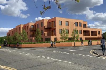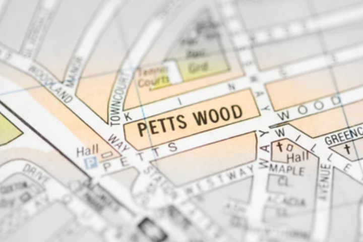
The Bromley neighbourhood of Petts Wood has been named one of the least deprived areas in England, according to new government data.
Located between Orpington and Chislehurst, Petts Wood ranks among the 20 least deprived areas in the latest Indices of Multiple Deprivation (IMD), the government’s official measure of poverty and inequality.
It was the only London neighbourhood to make the national top 20 list, placing Bromley alongside some of England’s most affluent postcodes such as Harpenden in Hertfordshire, Henley-on-Thames in Oxfordshire, and Horsell in Woking.
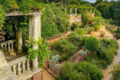
Petts Wood features leafy streets, large detached homes, strong commuter links into central London, popular local schools, independent shops, and pleasant open spaces such as Jubilee Country Park. This park, northwest of the main shopping area, was created in 1977 on land that once hosted anti-aircraft guns during the Second World War. The site, locally known as “The Gun Sites,” also served as the home of the 1st Petts Wood Scout Group.
These elements are reflected in local property values. Rightmove shows the average Petts Wood house price in 2025 was £674,600, compared to London’s overall average of £663,189.
Semi-detached homes in Petts Wood sold for an average of £710,487, terraced properties for £503,539, and detached houses for £986,229. Overall prices were 2% higher than the previous year, and close to the 2021 peak of £676,838.
The IMD rankings, compiled by the Ministry of Housing, Communities and Local Government, assess deprivation across England using seven key indicators: income, employment, education, health, crime, housing, and the state of the local environment. The data is based on very small geographical areas known as Lower Layer Super Output Areas (LSOAs), each containing around 1,500 residents.
The 2025 release marks the first update since 2019 and incorporates the social and economic impact of the Covid-19 pandemic. The figures apply only to England, as Scotland, Wales, and Northern Ireland calculate deprivation separately.
At the opposite end of the rankings, a neighbourhood in Jaywick, Clacton-on-Sea, Essex, was named the most deprived area in England. Officially listed as Tendring 018A, the area consists mainly of detached bungalows on the Brooklands Estate and has held the lowest deprivation score since 2019.
Jaywick falls within the parliamentary constituency of Clacton, represented by Nigel Farage, who was elected MP in 2024 with 46 per cent of the vote. It was his first successful attempt to win a seat in the House of Commons after seven previous campaigns.
The next five most deprived areas are all in Blackpool, covering parts of Talbot Square, the central pier, the South Promenade, Palatine Road, and the High Street near the railway station. Additional deprived areas include Broomgrove in Hastings, two more parts of Blackpool (North Shore and North East Centre), and central Rotherham.
Blackpool remains the most deprived local authority in England overall, with its neighbourhoods recording the highest average IMD scores. It is followed by Middlesbrough, Burnley, Manchester, and Birmingham. By contrast, St Albans ranks as the least deprived local authority, with its Harpenden and Marshalswick areas occupying several of the top positions for prosperity.
Petts Wood’s strong showing in the IMD reflects both its historical development and its enduring appeal. The area’s name first appeared in 1577 as “the wood of the Pett family,” referring to shipbuilders who leased the land for timber. Development remained limited until the late 19th century, with just one house—“Ladywood”—recorded in 1872.
Modern Petts Wood began to take shape in the late 1920s under developer Basil Scruby and architect Leonard Culliford, who designed its layout. Scruby paid the Southern Railway £6,000 to build Petts Wood station, helping establish the area as a commuter suburb. Shops and a cinema were later built beside the station, and large homes began to appear on the eastern side of the tracks.
The area suffered bombing during the Second World War due to its proximity to a key railway junction. Despite this, much of its original suburban layout and character were preserved.
In the post-war years, Petts Wood gained a reputation as a comfortable retreat for London’s media workers. In Streets Ahead, journalist Keith Waterhouse recalled that Fleet Street reporters favoured the suburb in the 1950s for its reliable all-night train service back to London, which offered, as he put it, “a heaven-sent excuse for one more for the road.”
The woodland that gave the town its name still survives and is managed by the National Trust. Originally covering 88 acres, the Petts Wood estate was saved from development in 1927 through public subscription.
In 1957, neighbouring Hawkwood and Edlmann Woods were added, expanding the site to more than 250 acres. The woods feature a mix of oak, birch, ash, hornbeam, and sweet chestnut, maintaining a natural link to the area’s historic origins.